Purdue Drone Tracks a Person in Woods Without GPS or Maps
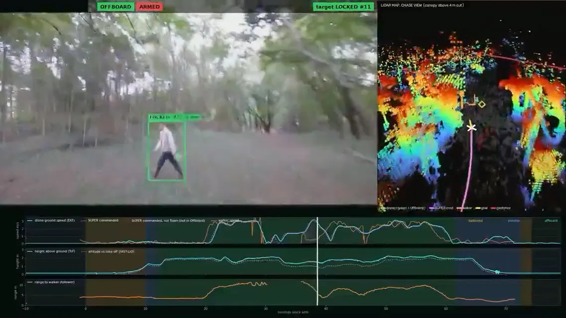
TechSpot reported that Purdue University’s IDEAS Lab demonstrated a quadcopter tracking a person through a forest without GPS, forest maps, or cloud computing. In a 44-second LinkedIn video posted by professor Aniket Bera, the drone navigates between trees, processes information onboard, and uses occlusion prediction to estimate a target’s direction when the person is hidden. The video labels the motion planner as SUPER and the altitude estimator as FAST-LIO.
The demonstration shows that onboard autonomous navigation can continue when satellite positioning, prior maps, and cloud processing are unavailable, according to TechSpot’s report on Bera’s video.
Serving tech enthusiasts for over 25 years. TechSpot means tech analysis and advice you can trust.
Why it matters: Plenty of off-the-shelf drones can tail a cyclist down a trail these days, but most of them still lean on GPS to keep track of where they are. That's a problem in a forest, where a thick canopy can make the signal pretty unreliable. A lab at Purdue University has now shown off a drone that chases a person through the woods with no GPS at all.
Purdue computer science professor Aniket Bera posted the 44-second video on LinkedIn last Friday. It shows a quadcopter from his IDEAS Lab weaving between trees to keep a person in frame. And the drone works it all out on its own computer, without a map of the forest to rely on. Bera says skipping the cloud matters because a drone banking hard around a thin branch can't afford to wait on a server somewhere.
#Purdue University#IDEAS Lab#SUPER#FAST-LIO#MaRS Lab#Intel NUC#Livox Mid-360